
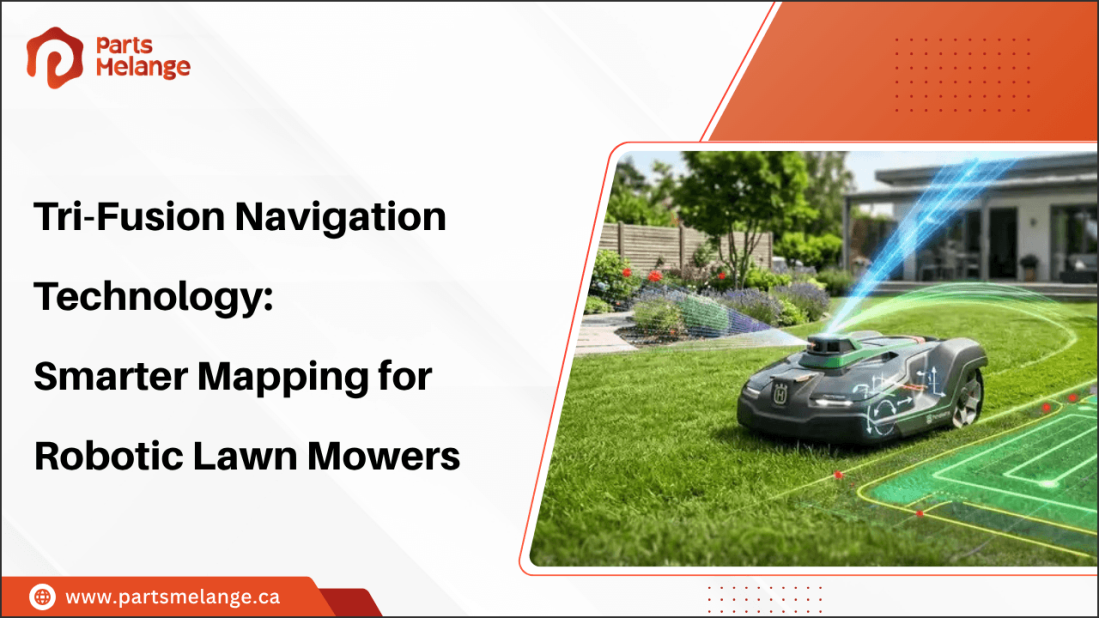
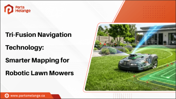
Robotic lawn mowers have moved beyond simple random mowing and boundary-wire guidance. Modern models can use positioning, cameras, and environmental sensing to create digital maps, plan mowing routes, and adjust their movement as lawn conditions change. Tri-Fusion navigation takes this approach further by combining multiple positioning technologies instead of depending on a single source of location data.
Tri-Fusion Positioning System combines LiDAR, NetRTK, and AI vision in one navigation system. The goal is to maintain accurate positioning across different lawn conditions, including open areas, shaded spaces, and areas with trees or other obstacles.
This guide explains how Tri-Fusion navigation works, how its technologies improve mapping and route planning, and what to consider when choosing a robotic lawn mower with this technology.
What Is Tri-Fusion Navigation Technology in Robotic Lawn Mowers?
Tri-Fusion Navigation is a navigation and positioning system for robotic lawn mowers. The technology is designed around the use of multiple navigation inputs rather than depending on a single source of location or environmental information. This approach lets the mower's navigation system use different types of data to determine its position and surroundings.
Tri-Fusion combines three navigation technologies:
360° LiDAR: A laser-based sensing technology used to collect spatial information about the surrounding environment.
NetRTK: A satellite-based positioning technology that uses network correction data to improve positioning accuracy.
AI vision: A camera-based system that processes visual information from the mower's surroundings.
Together, these technologies provide different types of data that support wire-free mapping and navigation across open lawns, shaded areas, tree-covered sections, and areas with obstacles.
How Does Tri-Fusion Navigation Combine Different Positioning Technologies?
Tri-Fusion combines data from 360° LiDAR, NetRTK, and AI vision to help the robotic lawn mower interpret its position and surrounding environment. Each technology provides a different type of information, and the navigation system brings these inputs together to create a more complete view of the mower's operating environment.
1. LiDAR for Environmental Mapping: LiDAR measures distances to objects and surfaces using laser pulses. In robotic lawn mowers, this information can be used to understand the mower's surroundings.
For example: LiDAR-equipped mower can detect physical structures such as trees, garden borders, fences, and other objects around its path. Mammotion says its 360° LiDAR provides 360° × 59° coverage and a detection range of up to 70 meters on the LUBA 3 AWD.
2. NetRTK for Precise Positioning: NetRTK combines satellite positioning with network-based correction data to provide precise positioning information. This helps the mower determine its location within the mapped operating area as it moves across the lawn.
Mammotion's iNavi service provides NetRTK positioning for compatible models, allowing the mower to use network correction without a separate physical RTK base station.
3. AI Vision for Object and Environment Recognition: AI vision uses cameras and image processing to interpret visible objects and features. This provides visual information that complements the spatial measurements collected by LiDAR and the location data provided by NetRTK.
How the Three Technologies Work Together
The three technologies therefore provide different types of information: LiDAR contributes spatial measurements, NetRTK contributes precise positional references, and AI vision contributes visual recognition. Their combination gives the mower more information than depending on any one technology alone.
For example, when the mower approaches trees, garden structures, or other objects, the system can use positioning data from NetRTK together with spatial measurements from LiDAR and visual information from AI vision. This combined information helps the mower interpret its surroundings and make navigation decisions based on multiple data sources rather than relying on a single positioning technology.
Smarter Lawn Mapping and Route Planning for Robotic Lawn Mowers
Tri-Fusion navigation uses combined positioning and environmental data to help a robotic lawn mower build a digital representation of its operating area and organize movement within defined mowing zones. The mapping process can account for lawn boundaries, obstacles, separate grass areas, and other features that influence where the mower can travel.
Mapping for Different Lawn Areas and Obstacles
A mapped lawn can include different areas and features, such as:
Open lawn areas: The mower can use the mapped area to establish where mowing should take place.
Tree-covered sections: Trees and other fixed structures can be represented as features within the mapped environment.
Garden borders and obstacles: Physical objects can be accounted for when defining areas and planning movement.
Multiple lawn zones: Separate grass areas can be mapped as individual zones when the property has divided mowing areas.
Narrow passages: Mapped pathways can help identify connections between different sections of the lawn.
Route Planning and Movement Across Complex Lawns
Once the lawn is mapped, the mower can use the collected positioning and environmental data to plan systematic mowing routes rather than moving randomly. It can follow predefined paths, navigate around mapped obstacles, and adjust its movement when environmental conditions affect the planned route.
This is especially useful on larger or more complex lawns, where trees, landscaping features, narrow passages, and separate grass areas can make navigation more difficult.
Key Benefits of Advanced Navigation Technology for Robotic Lawn Mowers
Advanced navigation combines precise positioning, environmental mapping, and visual recognition to give robotic lawn mowers more information about their surroundings. These capabilities can improve lawn mapping, positioning, obstacle detection, and route planning across different property layouts.
The key benefits can be summarized by how each navigation capability supports robotic mower operation
Benefit | How It Helps | Useful Lawn Areas |
Accurate Positioning | NetRTK helps maintain the mower’s location and route. | Large lawns and multiple mowing zones |
Environmental Mapping | LiDAR maps surrounding objects and structures. | Areas with trees, fences, and garden borders |
Obstacle Detection | LiDAR and AI vision help identify objects in the mower’s path. | Lawns with furniture, toys, branches, or tools |
Shaded-Area Navigation | Multiple inputs support navigation when conditions vary. | Tree-covered and shaded lawn sections |
Wire-Free Mapping | Digital maps define mowing areas without boundary wires. | Irregular or divided lawn layouts |
Systematic Mowing | Digital maps help the mower follow organized mowing patterns. | Large lawns requiring consistent coverage |
Complex-Lawn Navigation | Combined sensor data supports movement around lawn features. | Slopes, narrow paths, and landscaped areas |
By combining precise positioning with environmental sensing and visual recognition, Tri-Fusion supports more structured mapping, navigation, and route planning across different lawn layouts.
Factors That Can Affect Robotic Lawn Mower Navigation Performance
Multiple positioning and sensing technologies can improve robotic mower navigation, but real-world conditions can still influence how accurately the mower maintains its position, interprets the lawn, and follows planned routes.
GPS and RTK Positioning Dependence: Satellite-based positioning can be influenced by the surrounding environment. Buildings, dense tree cover, and other obstructions may affect positioning conditions and should be considered when evaluating navigation performance.
Navigation Challenges in Dense Vegetation: Trees, shrubs, and thick vegetation can create more complex environments for robotic mower navigation. These areas may require the mower to process more environmental information when maintaining a route.
Complex Lawn Layouts and Obstacles: Narrow passages, steep sections, closely spaced obstacles, and multiple lawn zones can make route planning more demanding. Accurate mapping helps the mower organize these areas and follow its planned mowing paths.
Network Dependence for NetRTK: NetRTK uses network-based correction services, so network connectivity and service availability are relevant to positioning performance. If correction data is unavailable, the mower may have less access to the positioning information provided by the service.
Mapping and Route Planning Requirements: Navigation performance also depends on how accurately the lawn is mapped. Clearly defined mowing areas, boundaries, obstacles, and routes help the mower organize its movement across different sections of the property.
Overall, lawn layout, positioning conditions, vegetation, network availability, and mapping accuracy can all influence how a robotic mower navigates and follows its planned routes.
Summary: How Tri-Fusion Navigation Makes Robotic Mowing Smarter
Tri-Fusion navigation combines 360° LiDAR, NetRTK, and AI vision to give robotic lawn mowers multiple sources of positioning and environmental information. This helps support accurate lawn mapping, obstacle detection, route planning, and navigation across different lawn conditions.
By combining these technologies, robotic mowers can navigate more systematically across open lawns, shaded areas, tree-covered sections, slopes, and complex layouts. However, factors such as positioning signals, connectivity, and lawn conditions can still affect navigation performance.
Key Takeaways
Tri-Fusion combines LiDAR, NetRTK, and AI vision.
LiDAR supports environmental mapping and obstacle detection.
NetRTK provides precise positioning data.
AI vision adds visual object recognition.
The technology supports wire-free mapping and planned mowing routes.
Lawn layout and environmental conditions can affect performance.
Keep your lawn mower operating smoothly with the right replacement components. PartsMelange provides quality home and garden appliance replacement parts. Find lawn mower components such as cutting blades, drive motors, wheels, control boards, and more for maintenance and repairs.
References:
https://ca.mammotion.com/blogs/news/mammotion-tri-fusion-positioning-system
https://ca.mammotion.com/products/luba-3-awd-robot-lawn-mower
https://mammotion.com/pages/luba-mini-awd-lidar
FAQs
How does Tri-Fusion navigation work on robotic lawn mowers?
It combines positioning, spatial, and visual data to help the mower determine its location, understand its surroundings, detect obstacles, and follow planned mowing routes.
What are the three technologies used in Tri-Fusion navigation?
Tri-Fusion uses 360° LiDAR for environmental scanning, NetRTK for precise positioning, and AI vision for visual object and environment recognition.
Does Tri-Fusion navigation work under trees and in shaded areas?
Tri-Fusion can use LiDAR and AI vision alongside NetRTK to support navigation in shaded and tree-covered areas, although environmental and positioning conditions can affect performance.
Does Tri-Fusion eliminate the need for boundary wires?
Compatible Tri-Fusion robotic mowers can support wire-free lawn mapping, allowing mowing areas to be defined digitally instead of using traditional perimeter wires.
Disclaimer: This blog is for informational purposes only and provides general information about Tri-Fusion navigation technology. Information may vary depending on the equipment, software, and operating environment. |





Please complete your information below to login.
Sign In
Create New Account